Parts of Maine Received Over a Month's Worth of Rain This Week
- Tim Dennis
- May 4, 2023
- 3 min read

The system that has been plaguing New England since this past weekend is very slowly pulling away now. The track of this system has been very interesting. The storm dropped into the lower 48 from the northwest. The system then tracked southeastward, exiting land into the Atlantic Ocean in the south. The storm then worked up the coast and entered western New England. This is where the storm got stuck. It got blocked in by an Omega blocking pattern. The storm sat just to New England's west, unable to move, for several days. Just now is the storm starting to pull away.
Satellite loop from April 27-May 4:
When the storm was in its prime Sunday night, it caused some seriously very downpours. 2-4 inch totals were common across New England, with the highest being nearly 5 inches in Maine. This storm came during what had already been a very wet pattern. Over the course of April 26 to May 2, several cities in Maine and New Hampshire passed or came close to passing average rainfall for the entire month of May.
Augusta and Wiscasset Maine both surpassed average May rainfall. Augusta saw 4.9 inches, which is over an inch and a half above May averages. Wicasset saw even more rain, with over 5 inches falling. This is about 1.6 inches above May averages. Portland and Manchester both came close to May averages. Mt. Washington's summit saw nearly 2 feet of snow during this week; the mountain averages about 33 inches for April. The mountain also picked up over 6 inches of rain.
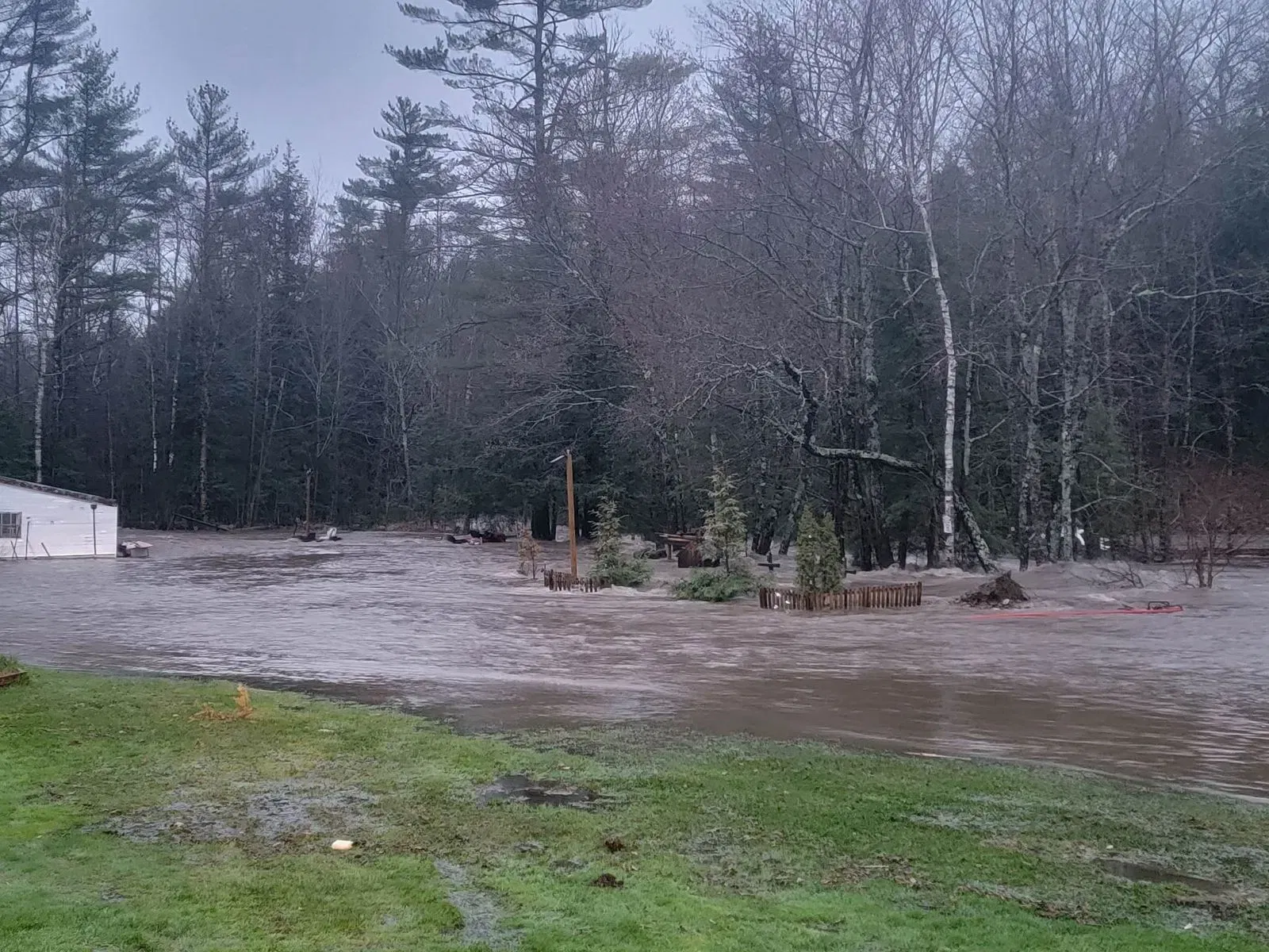
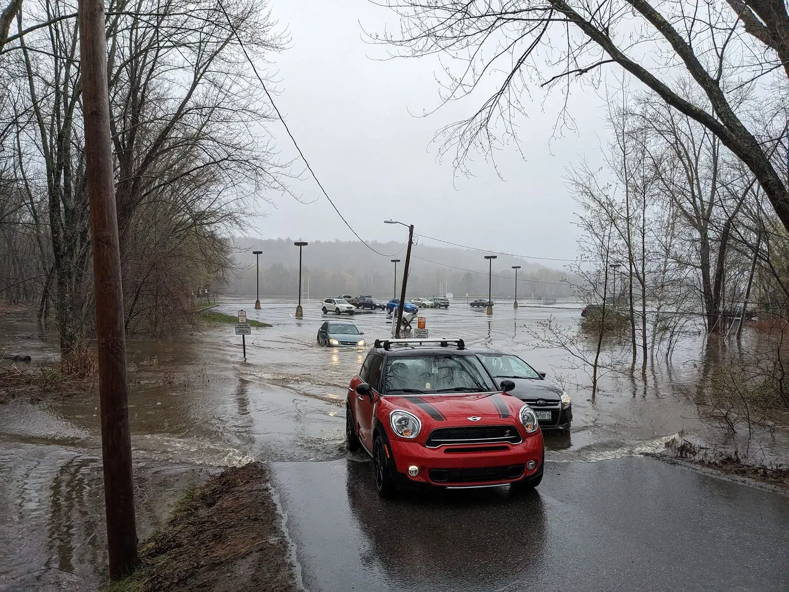
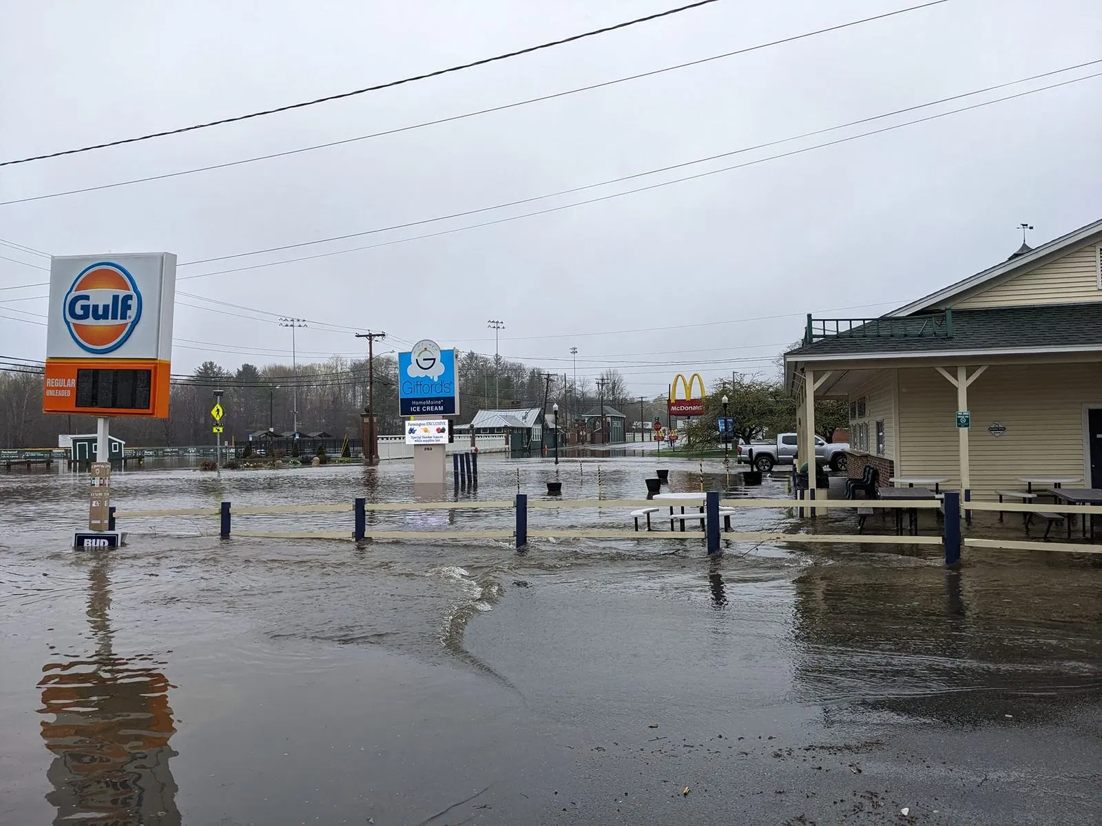
All of this rain, naturally, caused rivers to rise and rise. By Monday evening, 13 river gauges hit flood stage across Maine and New Hampshire. These rivers rose rapidly throughout Monday after the deluge. The Androscoggin river rose 10 feet in Lewiston. The Kennebec river at Hallowell rose to moderate flood stage and approached major flood stage. These swollen rivers flooded homes, businesses and athletic fields.

The extreme rainfall rates over western Maine and eastern New Hampshire also led to flash floods. A flash flood warning was issued just after 4am Monday and remained in effect through 11am. Throughout the morning, this warning continued to expand. New England Storm Center's flood warning map was looking quite messy Monday morning with all the warnings in place.
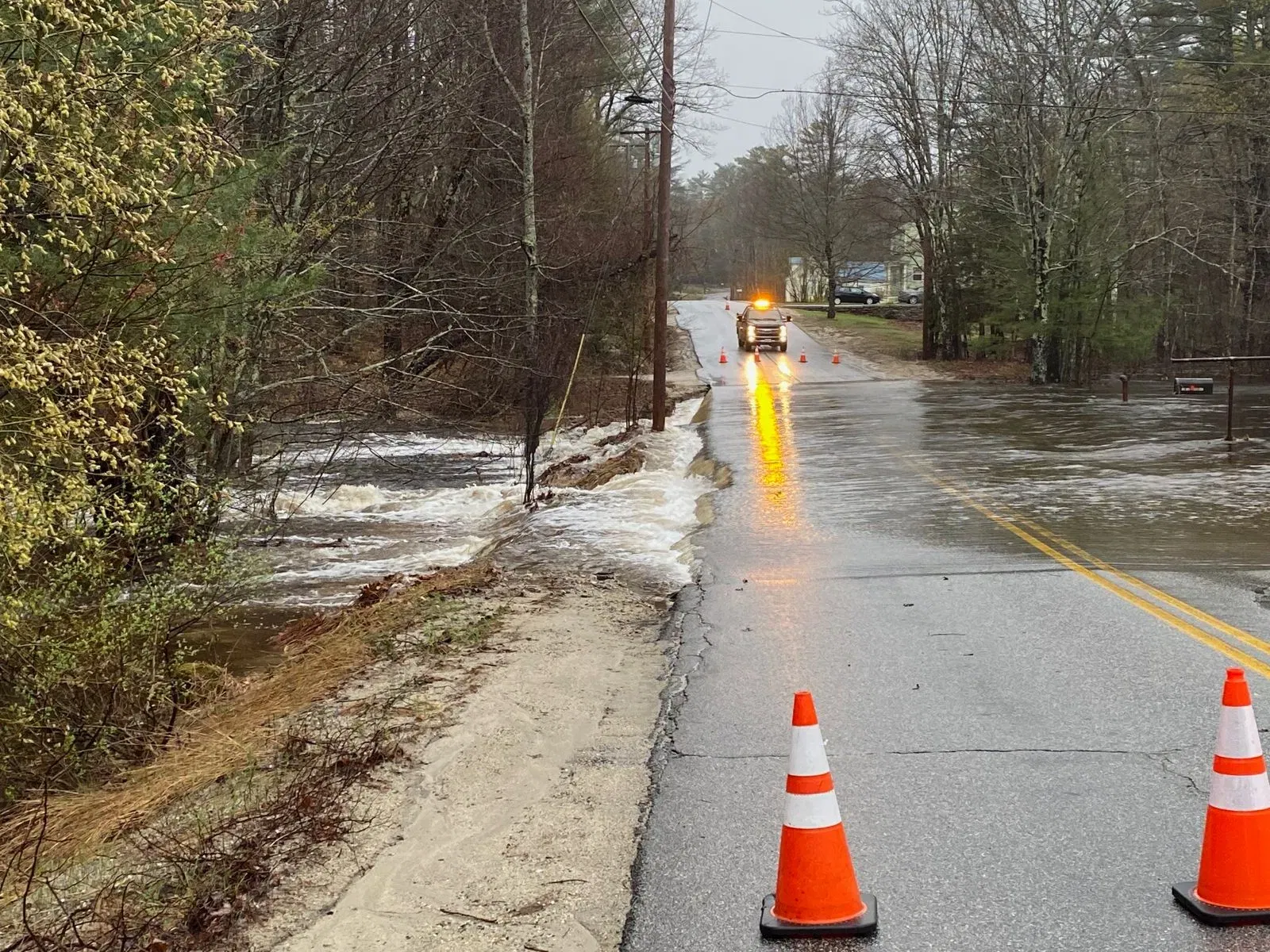
These flash floods washed out numerous roads across the two states. Pictures that came out Monday morning showed many badly damaged and collapsed roads. Some major routes were also affected. In New Hampshire, portions of route 16B and the Kancamagus Highway (route 112) were underwater. In Maine, route 9 saw floods and tree damage. Route 142 saw a culvert get washed out. Dixfield, Maine and Wakefield, New Hampshire were hit particularly hard with road washouts and closures.
In Conway, New Hampshire, first responders had to use a raft to transport someone to safety after suffering a medical event while driving on West Side Road. A video of this road showed a large section underwater.


Photos from: Fox23Maine; WGME; Tara Baldwin; Sam Shirly
On top of the flooding, Maine also strong wind gusts, with the highest being 70 miles per hour. This caused tree damage across the state. Many trees were completely uprooted, due to the fact that the ground was so saturated as the winds blew. This led to just over 60,000 in the state losing power.
Coastal flooding wasn't too much of an issue as tides were astronomically low. Still, a coastal flood statement was issued for much of the Maine coast amid very rough surf and splashover.
Fortunately, there have been no reports of death or injuries at this point from the floods. The coast of all the damage is still being assessed. Counties in Maine must finish their assements by May 10. At that point, the state will likely look into declaring a federal disaster to help cover the cost of repairs. This truly was an impressive flood event and storm across Maine and New Hampshire.


Comments