Cold Front, System to Bring Southern New England a Soaking Today & Tonight
- Tim Dennis
- Jul 31
- 3 min read

Moving through today, yesterday's cold front will likely slow down and stall just south of New England, resulting in a period of unsettled weather through Friday, mainly for the southern half of the region. A wave of low pressure will likely ride along the stalled out front, bringing clouds and bouts of showers, storms and downpours, mainly to southernmost New England.

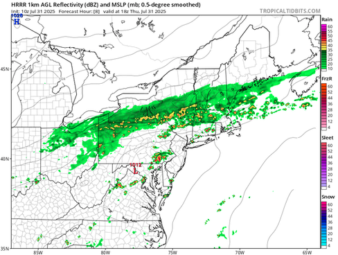
Showers will continue to ride along the cold front through the day today, gradually increasing in coverage throughout the day. Showers will be most numerous across central and western New England before spreading south and east later in the day. A period of more widespread rain is likely to develop by Thursday evening for the southern half of New England.
Below: HRRR showing potential weather this afternoon (1st image) and this evening (2nd image):


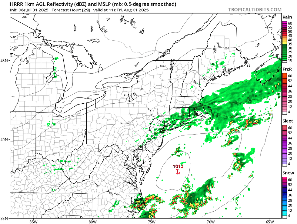
Embedded within this rainfall will likely be scattered downpours. Rain will likely be at its most widespread and heaviest from Thursday evening to Friday morning. The system will push out of the region from northwest to southeast through Friday, dragging the cold front away with it.
Below: HRRR showing potential weather Friday morning:
Now that we're in the near-term portion of the forecast, guidance seems to have settled on the boundary settling just to the south of New England, over the Mid-Atlantic. This continues the trend of interior southern New England seeing the most rainfall, which will likely be in the 1-3 inch range. Amounts will taper off rather quickly moving northward through New England, with the northern tier seeing little to no rainfall. The axis of heaviest rain is expected over the Mid-Atlantic, where the cold front will be directly over.

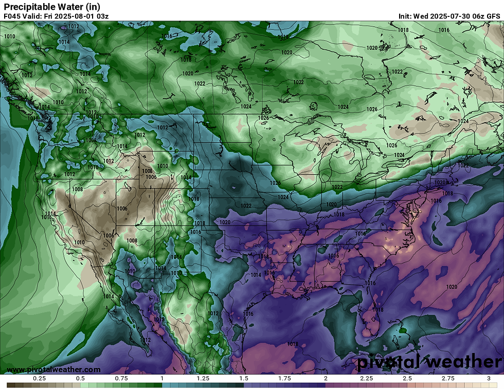
There are a couple factors lining up to bring this potential rainfall. Moisture will be highly elevated during this time, with precipitable water (PWAT) values approaching 1.5 to 2 inches. PWAT is a measure of water vapor contained in a column of air if it were to be condensed and collected. Basically, the higher the PWAT value, the higher rainfall rates could be, given a forcing mechanism for rain (low pressure system, frontal boundary, etc.) is present.
Below: Potential PWAT values Thursday night:
A sharp thermal gradient will also be in place, which could focus a band of heavier rainfall across a portion of southern New England. This banding is reminiscent of frontogenesis, which often sets up a band of heavier snowfall across the region during winter storms. Since we're still in July, we're talking about a band of heavier rain.
These factors will line up to bring scattered torrential downpours embedded within the rainfall. New England has been rather dry as of late, so this will be mostly a beneficial rain over anything else. The torrential downpours could lead to scattered and localized flash flooding in areas that see multiple ones move through or training. The overall flooding threat is on the lower end for New England, with this threat mainly centered over the Mid-Atlantic. A flood watch is in effect for Connecticut.

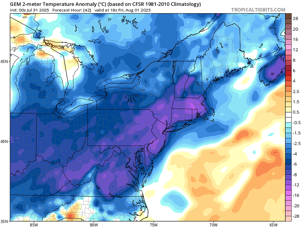
The other story with this system will be the much cooler temperatures. After the latest heat wave brought temperatures close to the century mark, widespread temperatures in the 70s will rule for today and tomorrow. Areas that see rain throughout this afternoon may struggle to break into the 70s today. Friday will see a drying trend, but will remain cooler. Overall, temperatures will be a good 10+° below average for many.
Below: CMC showing temperature departure from average Friday afternoon:
This upcoming weekend is currently shaping up to be a great summer weekend. A large ridge of high pressure looks to build into New England. This is poised to bring dry conditions, seasonable temperatures and low humidity. There's currently not a whole to say about this upcoming weekend in the weather department, with a beautiful stretch of weather once the front clears. New England is looking at a stretch of very quiet weather through midweek next week.
Below: Current weather map for Sunday morning (August 3):


Comments