Heat Begins to Ramp Back Up for New England Ahead of Cold Front
- Tim Dennis
- Jul 23
- 3 min read

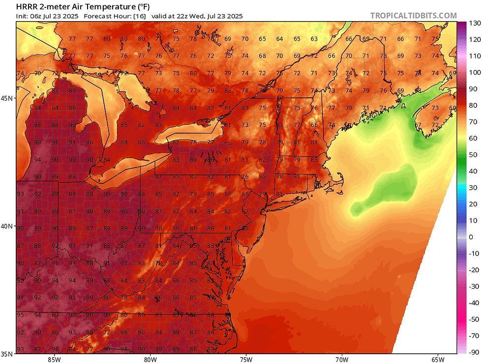
Today will act as a transition day from the refreshing air toward hotter and more humid weather as an area of high pressure shifts from the northwest to the south and east. This will promote the return of a southerly flow versus the more refreshing northerly flow early in the week. Widespread highs back into the 80s are likely this afternoon with dew points ticking back up toward what is expected in July. High pressure overhead will likely promote a sea breeze, keeping the coasts cooler once again. This will also keep calm and dry conditions around as well.
Below: HRRR showing expected high temperatures this afternoon:
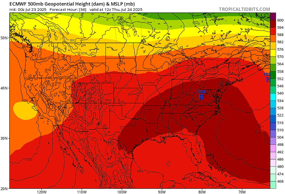
Late this week, a heat dome will continue to build across the south and midwest, with heat and humidity continuing to rise across New England as the ridge axis builds into the northeast. On Thursday, temperatures will be well into the 80s to low 90s for most of New England. New England will be more on the edge of the high heat, so the northern tier (with the exception of the Champlain Valley) won't get quite as hot.
Below: Geopotential heights on Thursday, showing the ridge axis building into New England:
The heat will likely peak for much of New England on Friday as temperatures aloft will peak. Temperatures at the 925mb level (about 2,500 feet above sea level) will peak in the 75-82° range, which will support surface temperatures well into the 80s to mid 90s. The northern tier will be kept cooler due to the earlier arrival of a cold front and more clouds. For southern and central areas, the cold front, and clouds associated with it, are unlikely to arrive before temperatures are able to soar. Some areas could see highs into the upper 90s across southern New England.
Below: Euro showing potential temperatures Friday afternoon, with a distinct line between the cooler and hotter weather across New England:

Humidity will also be shooting upwards late this week along with the heat. With that said, dew points have trended down slightly for both Thursday and Friday. This is mainly because of the potential of efficient mixing. This would help bring down slightly drier air to the surface. It will still be humid, especially on Friday, but the setup isn't perfect for humidity to reach its full potential as limiting factors exist.
That cold front mentioned earlier will continue to drop southward through the afternoon and evening Friday. It will likely enter into northern New England earlier in the day Friday and slow down as it moves southward. The front may not clear the south coast until Saturday morning. This front will bring lowering temperatures and humidity along with scattered thunderstorms as it crosses.

There remains some uncertainty with the exact timing of thunderstorms. The deep moisture and approaching front will likely allow scattered storms to develop ahead of the front, so all of New England will have the chance to see a storm Friday afternoon. With that said, storms will likely be most numerous where the front crosses in the afternoon and evening. This would also be where storms should be most likely to become strong to severe. Overall, how the weather plays out Friday (temperatures and storms) will all come down to the timing of the front.
The front will likely have cleared New England by the weekend, but its slow progress southward will cause it to stall near New England’s south coast as it weakens and eventually washes out. This means temperatures and humidity won't drop a great deal, but it will certainly be notably cooler and less humid behind the front.
Below: Current weather map for Sunday (July 27) showing the front to the south and a wave of energy riding along it:

It will likely be very seasonable with widespread 80s and dew points in the 60s, but slowly dropping. Sunday will likely be the wetter weekend day as a shortwave energy approaches the region, triggering afternoon showers, but a large, organized low pressure system isn't in the picture, so washouts this weekend are unlikely.


Comments