New England Remains Quiet and Seasonable with a Warm-Up on the Way
- Tim Dennis
- Aug 5
- 3 min read

A subtle cold front has dropped through northern New England through this morning. This front will slow down, weaken and eventually wash out through the day today. The front will help bring temperatures down a notch from yesterday and produce more clouds, but, it's a dry front for most. The best chance for the development of scattered storms will be across southern Vermont and interior New Hampshire, where instability and forcing will be highest. Storms will have the potential to produce quick and highly localized downpours.
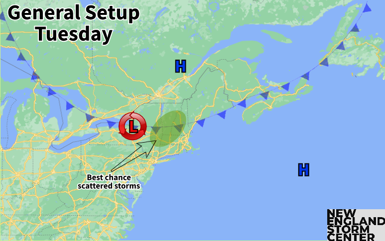
A persistent easterly flow will emerge thanks to the well-established high pressure over eastern Canada, which will keep the coastal plain a notch cooler than the interior over the next couple days. This moist easterly flow will help keep clouds around for the coastal plain, but the marine is also rather stable, which will make it that much more difficult for afternoon showers and storms to push eastward from western New England today through Thursday.
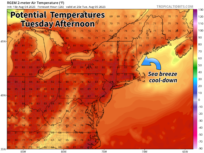
For the most part, Wednesday and Thursday will be copies of Tuesday. With no major weather features outside of surface high pressure around New England, it will be very seasonable with temperatures in the mid 70s to low 80s region-wide. Again, the onshore flow will keep the coast, particularly New Hampshire and Massachusetts, a bit cooler, but nothing notable. Scattered storms are again possible in the same general areas Wednesday and Thursday.
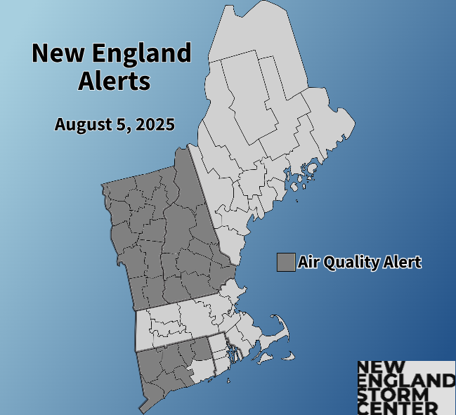
While wildfire smoke will be thinner over the next few days than it was yesterday, it will remain in place, creating a hazy look to the sky. It may be harder to tell given the increased cloud coverage versus yesterday's full sunshine. Air quality alerts are in effect for Vermont, New Hampshire and most of Connecticut.
The easterly flow will help keep smoke in check across eastern Massachusetts today, which is likely why air quality alerts are not in effect for the state today. Smoke is generally expected to thin out by the end of the week and weekend, but there's an inherent unpredictability to smoke forecasts, especially going out a few days. With that said, trends will be watched.
As we head toward the end of the week, high pressure will likely continue to dominate, keeping mostly to completely dry weather around. Toward the end of the week, an upper-level ridge will likely build over the east coast as surface high pressure continues to shift eastward. This will allow the onshore flow to turn more southerly, creating a warming trend. After a seasonable week with low humidity, temperatures and humidity will begin to climb with each day a notch warmer than the last starting Friday. Widespread mid 80s to 90s will likely return by Sunday.
Toward the end of the week and into next week, a large-scale ridge is expected to form across eastern Canada. This is consistent with a positive NAO (North Atlantic Oscillation) Index, which is expected to last through at least the middle of the month. This building ridge will support the rising temperatures over the next week. This comes as trends have shown the above average heights associated with the Canadian ridge expanding southward into the northeast US.
Below: Upper-level height anomalies showing the ridge building over eastern Canada next week:
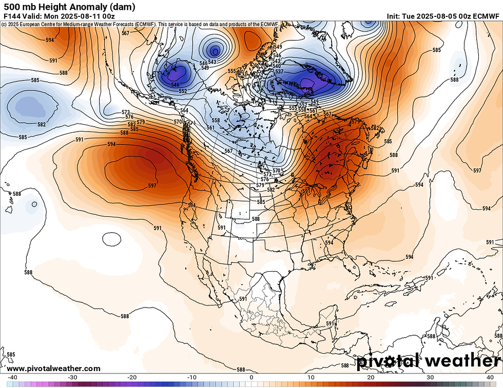
This ridge looks pretty persistent through the first half of August, which will likely help bring above average temperatures over the next couple weeks. That's not to say everyday will be scorching hot through the middle of the month, as cold fronts and other surface features will still likely bring bouts of relief, similar to how much of this summer has played out. With that said, confidence is high in above average temperatures next week, with an 80-100% chance from August 10-14.
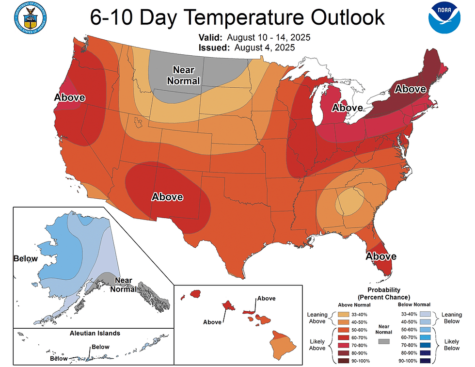
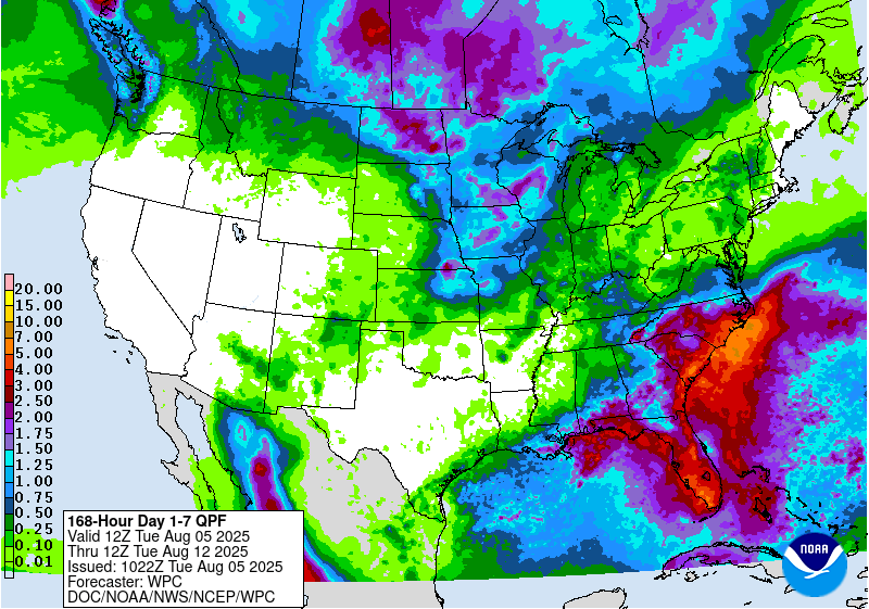
The Climate Prediction Center's 8-14 day outlook, which currently covers August 12-18, shows a 60-80% chance of above average temperatures for New England (the above map is the 6-10 outlook, covering August 10-14). This ridge could also lead to continued mainly dry weather as well, though that will come down to surface features that can't be predicted very well over a week out. Overall, much of New England is expected to see minimal rainfall over the next week, with the most falling across areas that are more likely to see storms over the next couple days.
Below: Current 7-day precipitation forecast. Much of New England is mostly to completely dry, with southern Vermont and interior New Hampshire seeing the most as scattered storms are expected to fire up today through Thursday:


Comments