New England Weather This Week: Pretty Quiet
- Tim Dennis
- Aug 25
- 3 min read
This week will feature a couple cold fronts at the beginning and end of the week with mostly dry, quiet and cooler weather in between. Overall, it will be another week that'll feel more like early fall rather than late summer.
MONDAY
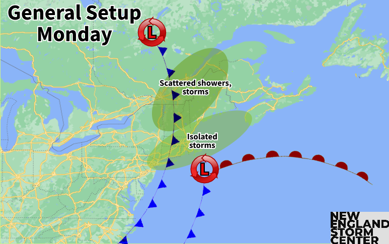
A cold front will slowly cross New England today. bringing with it the chance for a line of scattered showers and thunderstorms. At the same time, a weak area of low pressure will pass New England offshore. A few days ago, it was looking like this system would inject some energy and moisture into the front, allowing for a period of more widespread, soaking rainfall. This will not happen as the timing of the offshore system and cold front will not line up, or come close enough to each other for them to interact much.

This will keep the chance for storms on the lower end, with spotty coverage. The best chance for storms will be across the northern tier of New England, closer to the trough that the front is attached to. This line of storms will likely weaken and fall apart as you work southward in the region. The best chance for a more widespread rain and storms will be across interior Maine, where the offshore system will pass in the afternoon and evening, at the same time as the cold front.
Below: HRRR showing potential weather early this afternoon (1st image) and early this evening (2nd image):
TUESDAY-THURSDAY
After the passage of the cold front, a cooler and drier air mass will settle over New England. The region will remain under general and weak troughing, with a few weak systems moving through aloft, however, high pressure at the surface and a dry air mass will keep scattered shower chances very low during this time. The trough will likely allow for large, puffy clouds during the afternoons, but very limited chances of these clouds spitting anything out.
Below: 500mb height anomaly on Wednesday, showing the general troughing in place over the northeast:

The dry air mass and surface high pressure will keep temperatures somewhat on the cooler end by late August standards. It doesn't look quite as cool as last week, but true summer temperatures will generally be void this week, with 70s dominating for most and 60s across the higher terrain. Temperatures will be very uniform during this time, with little change in afternoon highs from day to day. Wednesday will likely be slightly cooler than the rest as the core of this air mass moves overhead.
The dry air mass and cool temperatures will be aided by low humidity as well, similar to last week. There once again won't be a feeling of humidity at all in the air through the middle of the week. This will also allow overnight lows to drop off with cool nighttime temperatures once again. Overnight lows will drop into the low to mid 50s for most, with some 40s in the higher terrain.

FRIDAY
Another cold front looks to drop into New England later Thursday through Friday. This will bring New England's next real shot at any precipitation after Monday's front. Naturally at this time range, overall amounts and timing are uncertain, but Friday will likely end up on the unsettled side. There isn't a strong signal for much organization at this time, so it's trending more toward a period of scattered showers and thunderstorms rather than a period of widespread rainfall. Temperatures will remain rather stagnant.

WEEKEND
Moving into the weekend, there's a signal for a weak upper-level low to cross northern New England on Saturday. This could bring additional rounds of showers moving into Saturday. At this time, the farther north you go in New England, the better the chance of seeing any precipitation from this system.
There's a spread in guidance, however, as some models show this system moving farther north with high pressure building into New England. With that said, Saturday could trend drier or wetter throughout this week and will be something to watch. Sunday and into Labor Day itself will likely see high pressure builds in, bringing dry and warm weather to the region.
Below: Current weather map for Saturday morning:


Comments