Slow-Moving Cold Front Approaches New England Tonight Into Monday
- Tim Dennis
- Jul 13
- 3 min read

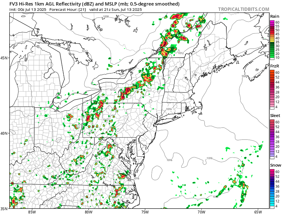
There has been little change in the overall setup for today. High pressure will remain offshore with a mid-level ridge in place. This will keep much of New England dry on Sunday as storm chances will generally be lower than Saturday. A cold front will be moving eastward out of the Great Lakes and into New York during the day. The ridge offshore will slow this front's eastward progress, however.

The timing of this system will keep the severe weather/flash flooding impacts centered over New York rather than western New England Sunday afternoon and evening. A majority of New England will remain dry, however, some of this storm activity could spill into westernmost New England later in the evening. This would most likely occur across northern Vermont.
Below: FV3 showing potential late this afternoon:
As of this morning's update, a "slight" risk of excessive rainfall and flash flooding (level 2 of 4) has been extended slightly eastward through Monday morning. It remains centered over Upstate New York. Any storms that push into the Champlain Valley/northern Vermont will be capable of producing heavy downpours this evening into the overnight hours.
Isolated flash flooding will remain possible wherever a storm pops up during this time. Storms will be weakening as they move into northern Vermont through the evening with the loss of daytime heating, so the overall flash flood threat does remain low for New England compared to New York today.
Below: Current excessive rainfall outlook for today and tonight:

On Monday, the cold front will slowly push through New England, bringing a better chance at more widespread shower and storm activity across New England. This front will provide stronger lift for storms, but the front will be weakening as it pushes eastward. Marginal instability and weak shear will continue to keep the threat of severe storms lower. The exact timing of the front will determine if there's a chance for a few stronger storms or if they all remain "garden-variety" The overall trends have slowed the cold front down more, likely not moving across New England until overnight Monday night.

The overall setup will be similar to Sunday, just shifted east a bit. This will put Vermont and northern New Hampshire more in the zone of potential heavy rain and isolated flash flooding. With a slow-moving front and weak wind fields, storms will likely once again be slow-moving. Moisture will pool ahead of the front, setting the stage for the potential for heavy rainfall rates. Precipitable water values (a measure of water vapor in the atmosphere that could become precipitation) will remain highly elevated.
Below: FV3 showing potential weather Monday afternoon:

Rainfall rates of 1+ inches an hour will again be possible within storms. The current threshold for flash flooding to occur across much of New England is 1.5-2.5 inches in an hour. The threshold for flash flooding within three hours is generally 2-3 inches. There will be the potential for training thunderstorms (when one storm moves over multiple areas) close to the frontal boundary given flow is parallel to the front. This would be more likely across western New England. One area that will need to be watched is the Northeast Kingdom as the flash flood threshold is currently below 2 inches within 3 hours given the recent flooding.

Overall, the flooding threat remains on the lower end for New England, though this could increase or decrease with today's trends and more detailed high-resolution guidance comes more into focus. Any flooding issues at this time will likely remain isolated and localized in nature. It will likely be similar to what has been occurring over the past few days, with localized flash flooding warnings issued as small storms bubble up, affecting a small area. Weak shear and marginal instability will keep the risk of severe storms low.
Heading toward the middle of next week, a ridge will build over the eastern United States, leading to increasing heat and humidity. How much moisture rides over the ridge will determine what the humidity levels will be, which will determine feels-like temperatures. As of now, heat index values in the mid 90s to low 100s will be possible for the typical warm spots in the region (Merrimack Valley, Connecticut River Valley and Champlain Valley). This heat wave will likely end late next week with the passage of a cold front.


Comments